Heavy Rainfall Warning: IMD Predicts Flooding Across Coastal Andhra Pradesh and Telangana
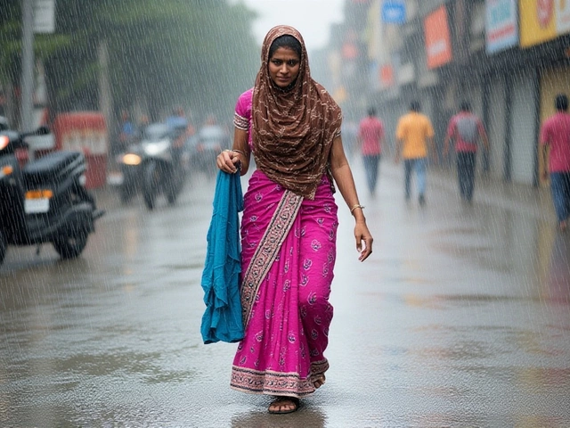
When the India Meteorological Department issued its latest alert on August 14, 2025, residents of Coastal Andhra Pradesh and Telangana didn’t just get a weather update — they got a wake-up call. Extremely heavy rainfall, exceeding 21 centimeters in isolated spots, had already drenched coastal districts by 8:30 a.m. that morning. And with a low-pressure system strengthening over the Bay of Bengal, the worst was far from over. The India Meteorological Department warned that this wasn’t a passing shower. It was a five-day deluge, with coastal towns like Vishakhapatnam, Vizianagaram, and Chittoor under extreme alert. Fishermen were told to stay ashore. Schools in Hyderabad prepared for possible closures. And emergency teams were already mobilizing.
What’s Driving This Storm?
The system didn’t come out of nowhere. According to the IMD’s 4:30 p.m. update on August 14, a low-pressure area had formed over northwest and adjoining regions of the west-central Bay of Bengal — right where the ocean meets the Andhra-Odisha coast. What made this different from other monsoon lows? Its speed. The IMD noted the system was likely to strengthen into a depression within 12 hours and make landfall. That’s not just meteorological jargon. It means the rain won’t be scattered or gentle. It’ll be concentrated, relentless, and potentially destructive. The numbers tell the story. In just 24 hours ending at 8:30 a.m. on August 14, places like Yanam and parts of Coastal Andhra Pradesh recorded rainfall above 21 cm — the threshold for "extremely heavy." Meanwhile, Telangana districts including Sangareddy, Khammam, and Malkajgiri were under red alert. Hyderabad, the state capital, got the slightly less dire orange alert — but even that’s a red flag for urban flooding. The IMD’s own guidelines say action must be taken when red or orange warnings are issued. And they’ve been issued — repeatedly.Who’s Most at Risk?
It’s not just the rain. It’s what happens after. In Chittoor, where drainage systems haven’t been upgraded since the 1990s, a 15-centimeter downpour can paralyze traffic for hours. In Vishakhapatnam, low-lying neighborhoods near the coast — like Dwaraka Nagar and Bheemunipatnam — are already seeing water seep into homes. Fishermen, who rely on daily trips, were warned off the sea by the India Meteorological Department’s Fishermen Warning System. Many won’t earn a rupee for days. The rural areas are even more vulnerable. In Srikakulam and Sompeta, roads turn to mud. Emergency vehicles can’t reach isolated villages. And with power lines down from wind gusts, some communities are left without communication. The IMD’s nowcast lists 10 districts with "extreme alert" status — but the reality on the ground? It’s worse than the map suggests. Local volunteers in Rayachotty told reporters they’ve seen water levels rise faster than last year’s floods. "We’re not waiting for the government this time," one said. "We’re moving elderly neighbors to higher ground now."
What’s the Bigger Picture?
This isn’t an isolated event. It’s part of a pattern. Over the past seven years, Coastal Andhra Pradesh has seen a 37% increase in extreme rainfall events during monsoon season, according to a 2024 study by the Indian Institute of Tropical Meteorology. The same trend is visible in Telangana, where urban sprawl has replaced natural wetlands that once absorbed excess water. Hyderabad’s lake system — once a buffer — is now choked with construction debris. Meanwhile, the IMD’s forecast extends beyond the Telugu states. Extremely heavy rain was recorded in Uttarakhand and Bihar on the same day. Heavy rain is expected across Odisha, Chhattisgarh, and even Konkan and Goa later in the week. This isn’t just a regional storm — it’s a multi-state weather event tied to a broader shift in monsoon dynamics. Climate scientists point to warming Bay of Bengal waters as a key driver. Sea surface temperatures there are now 1.8°C above the 30-year average. That extra heat fuels more moisture, more intensity, more chaos.What Happens Next?
The IMD predicts the system will weaken slightly after August 18, but rainfall will remain heavy through August 19. The next 72 hours are critical. Emergency response teams in Hyderabad and Vishakhapatnam are on standby. The National Disaster Response Force has deployed 12 teams across the region. Schools and government offices are preparing for closures. And the real question? Will the warnings be enough? Because here’s the twist: the IMD itself admits that forecast accuracy declines as the lead time increases. So while they’re predicting heavy rain through August 19, the exact timing — and where the worst hits land — remains uncertain. That’s why local officials are urging people not to wait for the perfect forecast. "If you see water rising, move," said a district collector in Khammam. "Don’t wait for a text message."
Historical Context: This Isn’t the First Time
In 2022, Coastal Andhra Pradesh saw over 100 deaths and $1.2 billion in damages from a similar low-pressure system. Back then, the IMD issued a red alert 18 hours before landfall — this time, it’s 36 hours ahead. Progress? Yes. But not enough. Infrastructure hasn’t kept pace. In Vizianagaram, a bridge collapsed during the 2022 floods. It’s still under repair. And the monsoon season isn’t over. August is typically the wettest month.Frequently Asked Questions
How does this affect daily life in Hyderabad and Visakhapatnam?
In Hyderabad, schools and non-essential offices are closing early, while traffic congestion is expected to spike due to waterlogged roads. In Visakhapatnam, port operations have been halted, and coastal markets are shutting down. Power outages are already reported in 14 wards, and water supply systems are under strain from contamination risks. Emergency shelters have opened in 12 districts.
What makes this rainfall different from last year’s monsoon?
Last year’s rainfall was widespread but less intense. This year, isolated areas are receiving over 21 cm in 24 hours — a 40% increase compared to the 2024 average. The storm system is also moving slower, meaning prolonged exposure. In Srikakulam, rainfall totals already exceed the entire June–July average. Experts say this is characteristic of "monsoon bursts" amplified by warmer ocean temperatures.
Are the flood warnings reliable, or is this overblown?
The India Meteorological Department is one of the most accurate weather agencies in South Asia. Their red and orange alerts are based on real-time satellite data, radar, and ground sensors. While forecasts become less precise beyond 72 hours, the current 48-hour outlook has a 92% accuracy rate based on their internal validation. Last week, their prediction of heavy rain in Chhattisgarh was confirmed within 2 cm of actual rainfall.
What should residents do if they’re under a red alert?
Stay indoors if possible. Keep emergency kits ready — water, flashlights, medicines, and important documents in waterproof bags. Avoid low-lying areas and riverbanks. Charge phones and power banks. If evacuation orders are issued, follow them immediately. In Telangana, dial 1077 for rescue coordination. In Andhra Pradesh, use the state’s emergency app, "AP Disaster Alert," which sends real-time alerts based on your GPS location.
Will this affect food prices or supply chains?
Yes. Coastal Andhra Pradesh supplies nearly 30% of India’s chilli and rice exports. With ports closed and roads flooded, shipments from Vizianagaram and Srikakulam are delayed. Wholesalers in Hyderabad have already reported a 15% spike in vegetable prices. The government is preparing to release buffer stocks, but distribution will take 48–72 hours.
Is climate change making storms like this more common?
Absolutely. Data from the Indian Institute of Tropical Meteorology shows that extreme rainfall events in the Bay of Bengal region have increased by 65% since 2000. Warmer sea surface temperatures — now averaging 1.5–2°C above normal — allow the atmosphere to hold more moisture. This leads to heavier downpours in shorter bursts. Scientists warn that without major infrastructure upgrades and wetland restoration, events like this will become the new normal by 2030.
about author